
C-MAP launches High Resolution Coastal Bathymetry
by Andrew Golden 3 Nov 2018 14:49 GMT
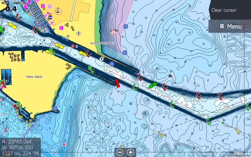
Coastal HRB Data V42 Turned On © Andrew Golden
C-MAP, a leader in digital marine cartography and cloud-based mapping, announced today the release of a new feature for C-MAP chart cards – Coastal High Resolution Bathymetry (HRB).
Offering anglers the latest and most detailed contour data for their C-MAP charts, Coastal HRB enhances current MAX-N+ cards with the highest resolution depth contour detail available. Combined with the custom depth shading available in all Navico chartplotters, it is especially helpful to fisherman who are looking to highlight those areas where fish gravitate. Available now, Coastal HRB comes with new chart purchases from data version v42.
"High Resolution Bathy gives C-MAP users the option to add another layer of more detailed contour data that reveal to anglers locations that are attractive to fish," said Leif Ottosson, CEO, Navico. "After listening to our customers, we know that detail is important for planning routes and trolling, however it can be distracting when on the move. Our new HRB also allows users to turn off the layer for a cleaner look while navigating."
The Coastal HRB is available for the following C-MAP MAX-N+ titles:
- USA East Coast and Bahamas
- USA West Coast and Hawaii
- Great Lakes, North East Coast and Approaches
- Central America and Caribbean
- Passamaquoddy Bay to Block Island
- Cape Cod, Long Island and Hudson River
- Block Island to Norfolk
- Norfolk to Jacksonville
- Florida and the Bahamas
- St. Lucie Inlet to New Orleans
- New Orleans to Brownsville
- San Diego to Santa Cruz
- Point Sur to Cape Blanco
- Cape Blanco to Cape Flattery
- Puget Sound, Juan de Fuca and San Juan Islands
- Victoria, British Columbia to Cape Scott
- San Juan Islands to Nigei Islands
- Queen Charlotte Sound to Dixon Entrance
- Hawaiian Islands
For more information on the new Coastal HRB, please visit
www.c-map.com.