
Monitoring endangered North Atlantic right whales in near real-time by sound, air, and sea
by NOAA Fisheries 15 Nov 2024 15:40 GMT
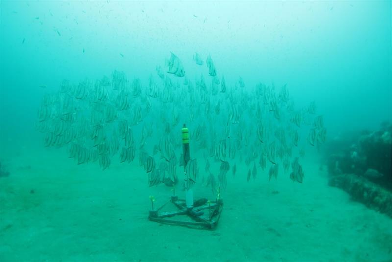
An example of an underwater acoustic recorder deployed on the ocean floor (in Gray's Reef National Marine Sanctuary in Georgia) to listen for whales © NOAA Fisheries
The annual North Atlantic right whale calving season, which begins in mid-November and runs through mid-April, is almost here once again.
There are approximately 370 North Atlantic right whales left, including fewer than 70 reproductively active females. With so few of these whales left, researchers closely monitor the waters along the entire East Coast of the United States. These research efforts span from Maine to Florida, covering the full range of the species in U.S. waters.
With a historic $82 million in funding from the Biden-Harris Administration's Inflation Reduction Act, NOAA Fisheries and our partners are using different strategies and technologies to monitor the health of, and threats to, right whales. They include passive acoustic monitoring and aerial and vessel-based surveys, which are part of our ongoing near real-time monitoring program.
Near Real-Time Monitoring Program Pilot Project: Using sound, aerial surveys, and vessel-based surveys to find whales
NOAA Fisheries and our partners collect data from monitoring platforms to track North Atlantic right whale locations and movement. We use both near real-time (available close in time to initial collection) and archival (available much later in time than initial collection) data. The data directly inform many of our conservation and management measures, such as reducing risk of vessel strikes. We anticipate future expansion and improvement of this program as we learn more about North Atlantic right whales and as technologies improve.
This program demonstrates the feasibility of monitoring whale presence throughout the U.S. range of North Atlantic right whales. In collaboration with an extensive group of research partners, we are collecting data from:
We use this information to map North Atlantic right whale presence for the entire U.S. East Coast throughout the year.
We use information from this monitoring to inform our analyses to mitigate the impacts of many different human activities in the ocean, including wind energy development. These data are also used to help reduce the risk of lethal North Atlantic right whale vessel strikes through the implementation of Dynamic Management Areas and Slow Zones. We also share sightings data through WhaleMap, WhaleAlert, and other early warning systems to raise awareness and enhance compliance and cooperation with mandatory and voluntary protection measures.
Passive Acoustic Monitoring: Listening for Whales
NOAA Fisheries and its partners have been using passive acoustic monitoring since 2004 to understand changes in North Atlantic right whale presence, distribution, and behavior. We use it to listen to whales since they make identifiable sounds to communicate with each other that underwater microphones can detect. This research could also translate into benefits for other marine mammals and fish; PAM is an effective method for monitoring all sound-producing marine animals. For example, we use the acoustic data collected across the East Coast to understand the presence and support conservation of humpback, blue, fin, sei, minke, sperm whales, beaked whales, and harbor porpoises.
Technologies can include:
- Archival recorders mounted on the seafloor
- Real-time recorders mounted on autonomous ocean vehicles (gliders)
- Real-time recorders moored to surface buoys or drifting buoy systems
- Real-time recorders towed off the stern of research vessels
- Real-time recorders dropped opportunistically from vessels
In Northeast and Mid-Atlantic U.S. waters, there are more than 50 archival moorings that record continuously year-round, five real-time gliders, and six real-time moorings. In Southeast U.S. waters, there are currently 32 archival moorings deployed during the calving season and one real-time mooring planned. NOAA Fisheries, the Bureau of Ocean Energy Management, and other partners are further expanding the Atlantic PAM Network.
Passive acoustic monitoring enables continuous monitoring of vocalizing whales, day and night. It can also be used to monitor whales during poor weather when aerial or vessel surveys are not possible. Passive acoustic monitoring has been particularly useful for improving our understanding of when and where right whales are along the U.S.
East Coast through the year. But, it is only useful when the whales are actually vocalizing, which is not always the case. To date, scientists have analyzed more than 950 PAM deployments in U.S. waters for North Atlantic right whale detections. These studies revealed that North Atlantic right whales are found along the entire Eastern Seaboard in winter months. Some whales are found in certain regions year-round.
Scientists use passive acoustic detections to inform and validate distribution modeling efforts for North Atlantic right whales. We also use these detections to mitigate impacts from human activities such as shipping, boating, and energy development. Long-term results have helped guide where to focus future monitoring efforts for other platforms, such as aerial surveys. Near real-time PAM has also helped direct ongoing aerial and vessel-based surveys to areas where North Atlantic right whales have recently been detected. All PAM detections of North Atlantic right whales can be found in the Passive Acoustic Cetacean Map.
Inflation Reduction Act Funds Take Passive Acoustic Monitoring Technology to a New Level
NOAA Fisheries is using $17.3 million in Inflation Reduction Act funds to expand the passive acoustic monitoring network along the entire East Coast. This investment improves upon existing near real-time monitoring capabilities.
Specific investments in PAM for North Atlantic right whales include:
- Supporting near-real time monitoring
- Expanding archival passive acoustic monitoring
- Modernizing and expanding the Passive Acoustic Cetacean Map
To date, we have invested more than $8.6 million of Inflation Reduction Act funding to enhance passive acoustic monitoring of North Atlantic right whales. These investments include:
- More than $3.3 million to the Woods Hole Oceanographic Institution to expand near-real time PAM monitoring
- $2.8 million for vessel time and associated fieldwork costs to deploy and maintain the PAM monitoring network
- $2.4 million to support NOAA Fisheries scientists to address research questions related to North Atlantic right whale presence and migration
These investments are part of NOAA Fisheries broader efforts to use transformational technologies to recover the North Atlantic right whale population. The importance of these transformational technologies for North Atlantic right whales and other protected species is supported and highlighted by our new initiative called Advanced Sampling and Technology for Extinction Risk Reduction and Recovery (ASTER3).
PAM Deployments in Southeast Calving Grounds: Using Sound to Monitor and Protect Whale Moms and Their Newborns
With Inflation Reduction Act funding, NOAA Fisheries also led a project to enhance near-real time monitoring during the 2023-2024 North Atlantic right whale calving season. Mother whales and their newborns spend a lot of time at the surface in waters close to shore, making them particularly vulnerable to vessel strikes. Mothers and calves are also fairly quiet on the calving grounds, vocalizing less than other individual right whales. PAM can still help us reduce the risk of vessel strikes by telling scientists, protected resource managers, and mariner communities when right whales in general are in the area. It could help protect mothers and calves if they are near other vocalizing whales. In addition, PAM in the southeast calving grounds will help us better understand vocalization behavior in this area, including the benefits or limitations of PAM in helping us understand right whale presence and mitigate threats. Mother whales and their newborns are critical to the survival of the species, so protecting them is a top priority.
From October 30 to December 15, 2023, NOAA Fisheries scientists deployed a network of 28 passive acoustic moorings to "listen in" on the calving season. The mooring deployments wrapped up just one week before the first North Atlantic right whale calf of the 2023-2024 season was seen off of the coast of South Carolina. Some newly deployed passive acoustic moorings are equipped with SoundTraps™ that record nearby sounds, from human sources such as boat traffic, and natural sounds, such as whales. These buoys are left in the water for three to five months and are recovered at the end of the calving season. This gives scientists a better understanding of where North Atlantic right whales are located and how they are using the habitat during these months. We recovered the passive acoustic devices in spring 2024. Additional Inflation Reduction Act funding will support repeating this PAM effort during the upcoming calving season.
Aerial Surveys: Sighting Whales from Above
NOAA Fisheries and our partners conduct aerial surveys in all major North Atlantic right whale habitats, including:
- Calving grounds in the Southeast United States
- Habitat along the Mid-Atlantic coast
- Foraging habitat in New England and Canada
We use photographs to identify individual right whales and for population monitoring. We submit photographs to the North Atlantic Right Whale Consortium's photo-identification database. NOAA Fisheries supports the database, and research partners at the New England Aquarium maintain it. Depending on where the whales are located, these photographs also aid in determining if temporary, dynamic vessel speed areas should be enacted.
Aerial surveys provide data that are critical to the recovery of the species. The importance of photographs from aerial platforms has grown considerably over time. In the 1990s, aerial surveys contributed an average of 18 percent of the North Atlantic right whale sightings. In the 2010s, nearly 60 percent of the sightings were from aerial surveys. In 2021, 99 percent of sightings were from aerial surveys.
Vessel-Based Research: Finding Whales at the Surface
Research on board vessels is important for North Atlantic right whale photograph identification, monitoring heath, studying behavior, and collecting biological samples. These activities include:
- Monitoring and studying right whale behavior on the calving grounds in the southeast United States
- Observing right whale migratory and feeding behavior in the northeast United States
- Tagging and taking biological samples of right whales under research permits
Data for Right Whale Sighting and Alert Systems
The Right Whale Sighting Advisory System is designed to reduce collisions between vessels and North Atlantic right whales by alerting mariners to the presence of the right whales. Whale sighting reports come from platforms including aerial surveys, passive acoustic monitoring, vessel sightings. NOAA Fisheries receives reports from the U.S. Coast Guard, commercial ships, fishing vessels, whale watch vessels, and the general public. We share these sightings with the North Atlantic Right Whale Consortium, OBIS-SEAMAP (Ocean Biodiversity Information System Spatial Ecological Analysis of Megavertebrate Populations), and WhaleMap. These data are also available to mariners and the general public through the Whale Alert App. When trained scientists see North Atlantic right whales or detections are reported and verified through the Right Whale Sighting Advisory System, they are visible on WhaleMap within 24 hours.
Data for Right Whale Location Forecasts
Scientists use data collected from right whale aerial surveys, PAM and other sources along the U.S. East Coast, to inform habitat-based density models. Research partners at the Duke University Marine Geospatial Ecology Lab develop these models, in collaboration with many partners, and use them to produce distribution maps. These maps predict where North Atlantic right whales are likely to be based on our understanding of long-term associations between right whales and environmental variables. They help inform project planning, policy decision making, and conservation efforts.
In 2023, NOAA Fisheries began supporting Duke University Marine Geospatial Ecology Lab to develop near real-time predictions of right whale distributions. These predictions will be based on long-term data on right whale habitat use and recent near real-time detections.
Scientific Partnerships
North Atlantic right whale near real-time monitoring relies on an extensive network of NOAA Fisheries scientists and collaborative partners. Coastwide, the North Atlantic right whale PAM network includes more than 20 research institutions and agencies. These include:
- U.S. Department of the Interior's Bureau of Ocean Energy Management
- NOAA's Stellwagen Bank National Marine Sanctuary
- NOAA's Gray's Reef National Marine Sanctuary
- U.S. Navy
- Woods Hole Oceanographic Institution
- Cornell University
- Duke University
- University of Maryland
- New Hampshire University
- University of Maine
- University of South Carolina
- University of Georgia
- JASCO Applied Sciences
- Oregon State University
- Syracuse University
- Regional Wildlife Science Collaborative
- The Nature Conservancy
- Wildlife Conservation Society
- States of Maine, New Hampshire, Massachusetts, Rhode Island, New York, and New Jersey
We also rely on a coastwide network of aerial survey research partners to maximize visual detection of North Atlantic right whales throughout their range. These include:
- U.S. Army Corps of Engineers
- Bureau of Ocean Energy Management
- U.S. Navy
- U.S. Coast Guard
- States of Maine, Massachusetts, New York, New Jersey, Georgia, and Florida
- Clearwater Marine Aquarium
- Center for Coastal Studies
- New England Aquarium
- Azura, LLC
- Fisheries and Oceans Canada